Newly Scientists Have Found a Lost Continent Beneath Antarctica
Some 160 to 200 million years ago, Antarctica, Africa, South America, India and Australia split from Gondwana and slowly moved to their current locations. Left behind, deep beneath the ice of Antarctica, is the evidence that can be linked to the younger continents.
While the “lost” continent is not Atlantis, the discovery will rewrite Earth’s geological history as we know it.
The remnants of extremely ancient, lost continents have been found beneath Antarctica’s thick ice sheets, thanks to the European Space Agency’s gravity mapping satellite through which researchers were able to peer beneath Antarctica’s Ice and map the terrain below. To the surprise of researchers, they found a long-lost landscape littered with cratons—large, stable blocks of our planet’s crust that are remnants of ancient continents.
These continental remnants are part of Earth’s lithosphere, which makes up the crust and upper mantle.
They are usually found at the center of modern continental plates, and studying these in detail allows scientists to understand how our planet evolved throughout history, and how it will continue developing.
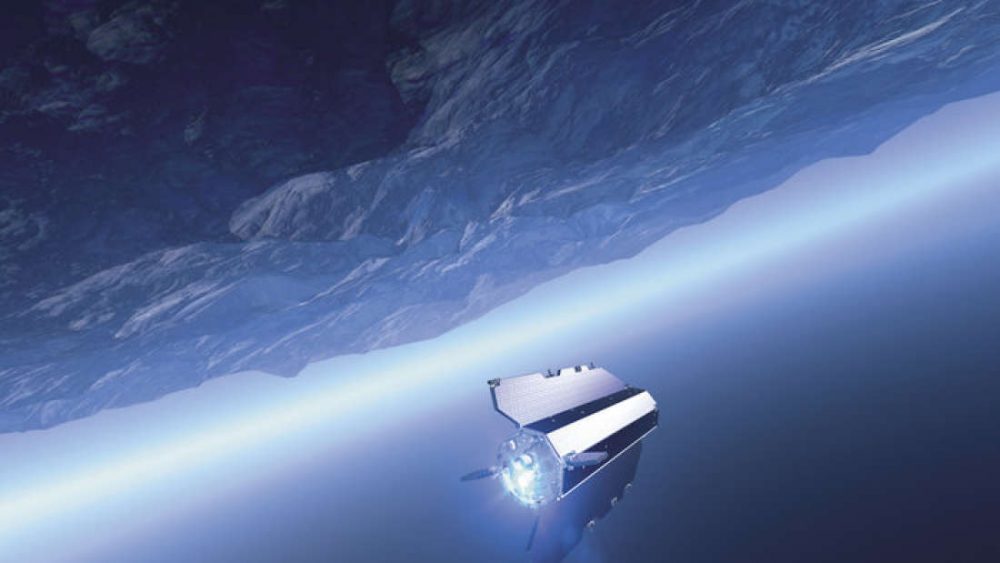
The discovery was made thanks to the European Space Agency’s Gravity Field and steady-state Ocean Circulation Explorer (GOCE) satellite, which was launched in 2009 in order to measure the strength of Earth’s gravity.
A morphed world hiding lost continents
The GOCE gathered data until 2013 after which it disintegrated near the Falkland Islands in the South Atlantic Ocean.
Thankfully, the massive amount of data it gathered during its mission was saved, and scientists have made good use of it.
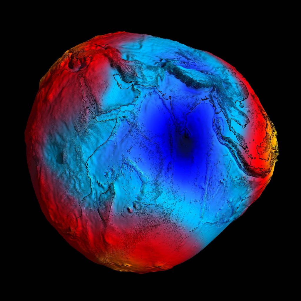
Basically, using gravity mapping data GOCE recorded, and just like we map the seafloor, scientists mapped what lies beneath Antarctica.
“These gravity images are revolutionizing our ability to study the least understood continent on Earth, Antarctica,” co-author Fausto Ferraccioli, science leader of geology and geophysics at the British Antarctic Survey, said in a statement.
As explained by the authors in the Journal Scientific Reports, they used GOCE data to understand how fast acceleration of gravity changes, as well as information about discrepancies/differences in horizontal and vertical components of Earth’s gravity field.
By using seismological data of our planet, they managed to build three-dimensional images of Earth’s plate tectonics and cratons.
A craton is an old and stable part of the continental lithosphere, where the lithosphere consists of the Earth’s two topmost layers, the crust, and the uppermost mantle. Having often survived cycles of merging and rifting of continents, cratons are generally found in the interiors of tectonic plates.
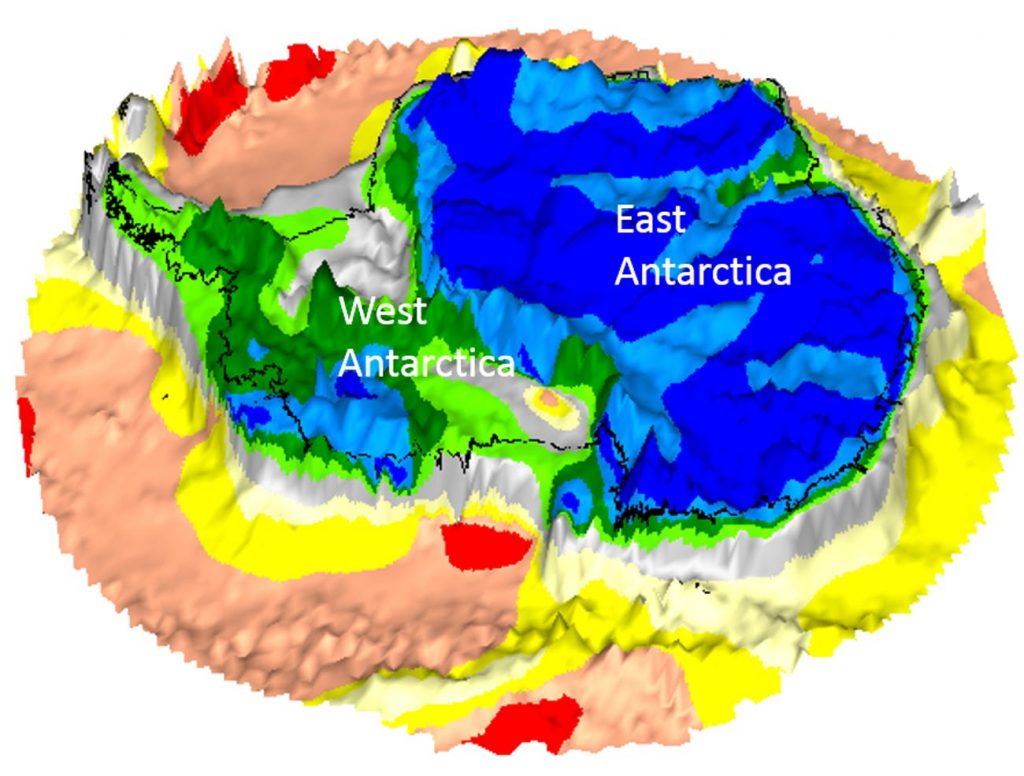
“In East Antarctica, we see an exciting mosaic of geological features that reveal fundamental similarities and differences between the crust beneath Antarctica and other continents it was joined to until 160 million years ago,” explained Ferraccioli.
The 3D images revealed that parts of West Antarctica have a notably thinner crust and lithosphere compared to East Antarctica, which has a ‘family likeness to Australia and India’.
East Antarctica contains remnants of land which is believed to have once been part of Gondwana, a long-gone ‘supercontinent’ that covered a mind-bending 39,000,000 square miles.
Ninety-eight percent of Antarctica is covered by two kilometers of ice, and studies like these help us understand the rich and plentiful history of Antarctica, while also showing us that there remains much to be found beneath the Ice.